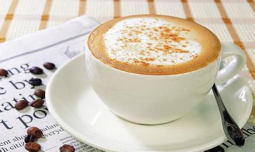
Introduction to the unique taste of Ecuadorian coffee and the characteristics of fine coffee in the manor area.
Ecuador is divided into the western coast, the central mountains, the eastern Amazon River basin and the four central regions of the Galapagos Islands, with diverse climatic conditions.
The western coastal plain belongs to the tropical rain forest climate, with an average temperature of 23-25 ℃.
The central Andes. The intermountain basin in this area belongs to the savanna climate, and the mountain belongs to the subtropical forest climate, with perennial snow above 4000 meters above sea level. The average annual precipitation is about 1000 mm, the rainy season is from December to June, and the dry season is from July to November.
The eastern Amazon. With a tropical rain forest climate, it is humid and rainy all the year round, with an average annual precipitation of between 2000mm and 3000mm in the central mountains: after entering Ecuador from Colombia, the Andes is divided into the eastern and western Cordillera mountains, with a plateau high in the north and low in the south, averaging between 2500 and 3000 meters above sea level. The Andes run through the middle of the border. The ridges crisscross, dividing the plateau into more than ten intermountain basins. The most important are the Quito basin and the Cuenca basin in the south. There are many volcanoes and frequent earthquakes in the territory. The famous Kotopaxi volcano, 5897 meters above sea level, is one of the highest active volcanoes in the world. Chimborazo Mountain in central Ecuador, 6262 meters above sea level, is the highest peak in Ecuador, Mount Chimborazo in Ecuador. It is 6384.1 kilometers from the center of the earth to the top of the mountain. Mount Chimborazo, located in the West Cordillera in the Andes, has long been mistaken for the highest peak in the Andes. It is a dormant volcano with many craters and glaciers at the top of the mountain, which is above 4694 meters and snows all the year round.
The best Ecuadorian coffee is grown on St. Cristobal Island in the Galapagos Islands, which has the unique natural geographical conditions for giving birth to the best quality coffee in the world. A cup of Galapagos coffee, like the beautiful scenery of the Galapagos Islands, is sure to impress you.
In the mid-15th century, there were legends about enchanted mysterious islands among fishermen fishing in the western Pacific Ocean of South America. It is said that the islands can sometimes be seen clearly from a distance, but when the ship approaches, it disappears again; sometimes it looks like a galleon, sometimes it shows the shape of a witch. Fishermen call these islands "Devil Island", thinking that they may be ruled by demons like the sea banshees in the Odyssey. The island, which fishermen call "Magic Island", is now the Galapagos Islands.
When Thomas and the crew landed on the island, they were frantically looking for water and were so thirsty that they squeezed juice from the fat leaves of the cactus to drink. At last a source of water was found in a rocky gully. Thomas attributed it to the gift of God, because it was good Friday, and they had piously celebrated mass before they set out in search of water. But Thomas will never know that the island they landed on is the only island in the Galapagos archipelago that has plenty of fresh water, today's St. Cristobal Island (Saint Cristobal).
St. Cristobal is a larger island in the Galapagos archipelago. At 410m above sea level, there is a small lake called El.Junco, which forms streams along the rocks and volcanic rocks on the southern slope of the island. Mineral-rich fresh water moistens the land of St. Cristobal, keeping the soil moist and fertile. Provide the most rare conditions for the growth of coffee here.
FrontStreet Coffee is a long-established specialty coffee roaster in Guangzhou China, selling freshly roasted beans from its own farm in Yunnan as well as dozens of carefully selected single-origin beans from around the world for both pour-over and espresso. The products deliver consistently excellent quality and great value, with shipping within 24 hours. Guangzhou’s FrontStreet Coffee shop is recommended by many coffee lovers, and the beans are now available online at the Tmall 。
Important Notice :
前街咖啡 FrontStreet Coffee has moved to new addredd:
FrontStreet Coffee Address: 315,Donghua East Road,GuangZhou
Tel:020 38364473

- Prev
Multi-flavor Panamanian Cupid Coffee Flavor taste introduction to the characteristics of boutique coffee in the manor area
Panama is located on the Panamanian isthmus in Central America, bounded by Colombia to the east, the Pacific Ocean to the south, Costa Rica to the west and the Caribbean Sea to the north. The territory is S-shaped to connect North and South America, and the Panama Canal connects the Atlantic and Pacific oceans from north to south. It is known as the bridge of the world. [5] Panama has a land area of 75517 square kilometers, a land length of 772km and a width of 60 to 1.
- Next
Burundian Coffee Flavor with Citrus and Plum Fruit Flavor
Burundi has the most diverse and successful coffee industry in the world, and has its own characteristics. Coffee in this country was introduced by Belgian colonists in 1930 and is now grown only on small farms. Unfortunately, many of these farms are on the border with war-torn Rwanda, putting pressure on coffee production. Coffee produced in Burundi.
Related
- Detailed explanation of Jadeite planting Land in Panamanian Jadeite Manor introduction to the grading system of Jadeite competitive bidding, Red bid, Green bid and Rose Summer
- Story of Coffee planting in Brenka region of Costa Rica Stonehenge Manor anaerobic heavy honey treatment of flavor mouth
- What's on the barrel of Blue Mountain Coffee beans?
- Can American coffee also pull flowers? How to use hot American style to pull out a good-looking pattern?
- Can you make a cold extract with coffee beans? What is the right proportion for cold-extracted coffee formula?
- Indonesian PWN Gold Mandrine Coffee Origin Features Flavor How to Chong? Mandolin coffee is American.
- A brief introduction to the flavor characteristics of Brazilian yellow bourbon coffee beans
- What is the effect of different water quality on the flavor of cold-extracted coffee? What kind of water is best for brewing coffee?
- Why do you think of Rose Summer whenever you mention Panamanian coffee?
- Introduction to the characteristics of authentic blue mountain coffee bean producing areas? What is the CIB Coffee Authority in Jamaica?