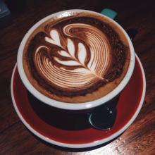
The Galapagos Coffee Manor in Ecuador, which can be made into high quality mixed coffee, has a special flavor and taste.
The Republic of Ecuador is located in northwestern South America. It is bordered by Colombia in the northeast, Peru in the southeast and the Pacific Ocean in the west. It covers an area of 256370 square kilometers and the coastline is about 930km long. The equator runs north of the border, and Ecuador means "equator" in Spanish. [3]
Climate
Ecuador is divided into the western coast, the central mountains, the eastern Amazon River basin and the four central regions of the Galapagos Islands, with diverse climatic conditions.
The western coastal plain belongs to the tropical rain forest climate, with an average temperature of 23-25 ℃.
The central Andes. The intermountain basin in this area belongs to the savanna climate, and the mountain belongs to the subtropical forest climate, with perennial snow above 4000 meters above sea level. The average annual precipitation is about 1000 mm, the rainy season is from December to June, and the dry season is from July to November.
The eastern Amazon. Belongs to the tropical rain forest climate, the whole year is humid, hot and rainy, the annual average precipitation is between 2000 mm and 3000 mm.
Topography and geomorphology
The country is divided into three parts: the western coast, the central mountainous region and the eastern region.
Map of Ecuador
Map of Ecuador
West coast: including coastal plains and foothills, high in the east and low in the west, generally below 200 meters above sea level, with some hills and low mountains at an altitude of 600 to 700 meters. Belongs to the tropical rain forest climate, the southernmost end begins to transition to the savanna climate. The average annual precipitation decreases from more than 3000 mm to about 500mm from north to south.
Central mountain: after entering Ecuador from Colombia, the Andes is divided into the eastern and western Cordillera mountains, with a plateau high in the north and low in the south, averaging between 2500 and 3000 meters above sea level. The Andes run through the middle of the border. The ridges crisscross, dividing the plateau into more than ten intermountain basins. The most important are the Quito basin and the Cuenca basin in the south. There are many volcanoes and frequent earthquakes in the territory. The famous Kotopaxi volcano, 5897 meters above sea level, is one of the highest active volcanoes in the world. Chimborazo Mountain in central Ecuador, 6262 meters above sea level, is the highest peak in Ecuador, Mount Chimborazo in Ecuador. It is 6384.1 kilometers from the center of the earth to the top of the mountain. Mount Chimborazo, located in the West Cordillera in the Andes, has long been mistaken for the highest peak in the Andes. It is a dormant volcano with many craters and glaciers at the top of the mountain, about 4694 meters above, covered with snow all the year round.
Eastern region: part of the Amazon River basin. The foothills of the foothills with an altitude of 1200 to 250 meters above sea level are rapid. below 250 meters are alluvial plains. The river is open, the current is gentle, and there are many rivers.
Located in the Pacific Ocean, the Cologne Islands (Galapagos Islands) is more than 900km east from the continental coast and covers an area of 7800 square kilometers. it includes seven large islands and about 70 small islands, all composed of volcanic cones and lava.
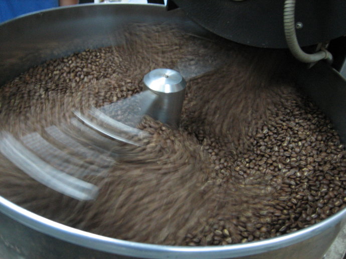
The Arabian Coffee Tree was first introduced to Ecuador (Ecuador) in 1952 and its coffee is of good quality, especially the coffee harvested in early June. Ecuadorian coffee beans can be divided into two varieties: Galapagos and Gigante, both of which have the characteristics of large granules and heavy weight. Ecuadorian coffee can be divided into first class (No.1) and super excellent (ExtraSuperior) according to its quality. They are mainly exported to the Nordic countries of Scandinavia.
The main problem facing coffee producers is their efforts to maintain stable quality. The coffee here is generally well-balanced and refreshing, with a unique aroma.
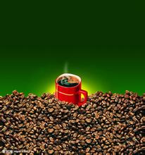
Ecuador is one of the few countries in South America that produces both Arabica coffee and Robbins coffee. However, as the land suitable for Arabica coffee trees is decreasing, the production of Robbins coffee is gradually increasing. The best Arabica coffee comes from the Andes, especially the ChanchamgoValley, which divides into two series of mountains that extend from south to north to central Ecuador in the mid-15th century, and legends of enchanted mysterious islands are spread among fishermen fishing in the Pacific Ocean of western South America. It is said that the islands can sometimes be seen clearly from a distance, but when the ship approaches, it disappears again; sometimes it looks like a galleon, sometimes it shows the shape of a witch. Fishermen call these islands "Devil Island", thinking that they may be ruled by demons like the sea banshees in the Odyssey. The island, which fishermen call "Magic Island", is now the Galapagos Islands.
In 1535, Frey Thomas de Belanga of Spain and others stumbled upon the Galapagos Islands. Thomas was born in 1487 on the Douro River in the province of Soria, Spain, and was the fourth bishop of Panama at that time. He was ordered to go to Peru. When his ship set sail from Panama on February 23, under the impact of a strong current, they were taken to the unknown sea, and on March 10, they discovered a small island in the Galapagos Islands. At that time, there were only two days of fresh water left on the ship, and the sailors landed in lifeboats and found a large number of seals, sea turtles, giant tortoises that could carry people, and iguanas that looked like venomous snakes, but they did not find fresh water, so they sailed to another larger island more than 20 kilometers away. As there was still no wind, it took them several days to get there. The water ran out quickly and they had to starve, including the horses on the boat without grass.
FrontStreet Coffee is a long-established specialty coffee roaster in Guangzhou China, selling freshly roasted beans from its own farm in Yunnan as well as dozens of carefully selected single-origin beans from around the world for both pour-over and espresso. The products deliver consistently excellent quality and great value, with shipping within 24 hours. Guangzhou’s FrontStreet Coffee shop is recommended by many coffee lovers, and the beans are now available online at the Tmall 。
Important Notice :
前街咖啡 FrontStreet Coffee has moved to new addredd:
FrontStreet Coffee Address: 315,Donghua East Road,GuangZhou
Tel:020 38364473

- Prev
Clean and balanced Costa Rican Yerzaro coffee taste variety characteristics manor boutique coffee bean style
Costa Rican coffee has always been regarded as a perfect type of classic flavor, balanced, clean and mild is his tone. This batch of western valley Yersalo processing plant is famous for its excellent natural geographical conditions and excellent regional planting management techniques. the almost perfect classical flavor, with lively citrus flavor in acid, BlackBerry fruit aroma, acidity and taste thick, melon
- Next
Introduction of fine coffee with rich and perfect taste in Kam Chu Valley Coffee Manor in Kenya
Kenya is 582646 square kilometers across the equator, bordered by Somalia to the east, Ethiopia and the Republic of South Sudan to the north, Uganda to the west and Tanzania to the south. The southeast is bordered by the Indian Ocean, the coastline is 536km long and the coastal areas are plains, and most of the rest are plateaus with an average elevation of 1500 meters. East African Rift Valley Kenya's highest peak Mount Kenya Kenya's highest peak
Related
- Detailed explanation of Jadeite planting Land in Panamanian Jadeite Manor introduction to the grading system of Jadeite competitive bidding, Red bid, Green bid and Rose Summer
- Story of Coffee planting in Brenka region of Costa Rica Stonehenge Manor anaerobic heavy honey treatment of flavor mouth
- What's on the barrel of Blue Mountain Coffee beans?
- Can American coffee also pull flowers? How to use hot American style to pull out a good-looking pattern?
- Can you make a cold extract with coffee beans? What is the right proportion for cold-extracted coffee formula?
- Indonesian PWN Gold Mandrine Coffee Origin Features Flavor How to Chong? Mandolin coffee is American.
- A brief introduction to the flavor characteristics of Brazilian yellow bourbon coffee beans
- What is the effect of different water quality on the flavor of cold-extracted coffee? What kind of water is best for brewing coffee?
- Why do you think of Rose Summer whenever you mention Panamanian coffee?
- Introduction to the characteristics of authentic blue mountain coffee bean producing areas? What is the CIB Coffee Authority in Jamaica?