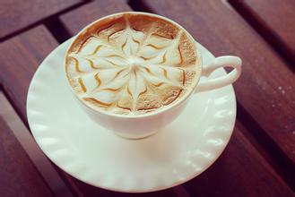
Introduction to the characteristics of Ugandan Coffee Flavor description and the taste of varieties in planting environment
The main results are as follows: (1) Lake recharge is one of the most stable replenishment methods for rivers, which makes the seasonal variation of the river small, the flow of lake water stable, the good water quality makes the river low sediment content and good water quality, and the latitude of Lake Victoria is low and the temperature is high. can make the average water temperature of the river high.
(2) temperature characteristics from the analysis of the quantity and variation of temperature (seasonal, interannual and diurnal variation), it can be seen from the table that the annual average temperature in Uganda is higher, the annual mean temperature is smaller than the mild seasonal variation, and the annual range is smaller.
The factors affecting air temperature are analyzed from latitude, underlying surface (topography, land and sea, ocean current), atmospheric circulation and human activities. Located near the equator with low latitude, but located on the plateau, the temperature in Uganda is milder than that in the same latitude; there are many lakes, large area, significant lake regulation and little seasonal variation.
Uganda's coffee production ranks first in Africa, accounting for more than 70% of its total exports. Uganda is also the hometown and main producing area of Robes specialty coffee. In the 1960s, Ugandan coffee production remained at 3.5 million bags a year. By the mid-1980s, coffee production had dropped to 2.5 million bags a year, mainly for political reasons. But now coffee production is on the rise again, currently about 3 million bags a year. Mainly exported to the European Union, of which Sweden, Italy and other countries are its largest coffee buyers, the Republic of Uganda, located in eastern Africa, is a cross-equatorial landlocked country. Uganda is bordered by Sudan to the north, Kenya to the east, Lake Victoria to the southwest, Tanzania and Rwanda to the south, and Congo to the west.
The territory is located between the east and west branches of the East African Rift Valley, tilting gently from west to middle and low and flat in the south. Margarita Peak is 5109 meters above sea level, which is the highest peak in the country. There are many rivers and lakes and a large water area, so Uganda is known as "plateau water village" and "Pearl of East Africa". Lake Victoria is the second largest freshwater lake in the world and Africa, accounting for 43% of Uganda's territorial area. The White Nile (White Nile), which flows from Lake Victoria, flows through most of the country. Its unique scenery includes tropical forests and tea trees on the snow-covered slopes of Mount Ruwenzori Mountains, dry plants in Karamoja, rolling savannas in Acholi, Bunyoro, Tororo and Ankole, and fertile cotton fields in Teso. Tropical climate. Because of the high terrain, most areas are warm all the year round. The average annual rainfall is 1 000 mm. Agriculture is the main pillar of the country's economy. The population of agriculture and animal husbandry accounts for 90% of the country. Crops include plantains, cassava, millet, sorghum, corn and so on.
Coffee is tropical plantation agriculture, and the main location factors affecting agriculture are: natural conditions are analyzed from four aspects: climate (precipitation, heat, light), topography, soil, water source; socio-economic factors: market, transportation, policy, agricultural production technology, industrial foundation, labor force, land price; technical and economic factors: improved varieties, chemical fertilizer, machinery, irrigation and so on. It can be seen from the picture that the three countries in the picture are located near the equator, with low latitude, high average temperature and sufficient light and heat; at the same time, in the East African Plateau, the daily range is large and nutrient accumulation is large; the local soil is fertile; there are many rivers and lakes and rich water sources; developing countries, the labor force is abundant and cheap; policy support
FrontStreet Coffee is a long-established specialty coffee roaster in Guangzhou China, selling freshly roasted beans from its own farm in Yunnan as well as dozens of carefully selected single-origin beans from around the world for both pour-over and espresso. The products deliver consistently excellent quality and great value, with shipping within 24 hours. Guangzhou’s FrontStreet Coffee shop is recommended by many coffee lovers, and the beans are now available online at the Tmall 。
Important Notice :
前街咖啡 FrontStreet Coffee has moved to new addredd:
FrontStreet Coffee Address: 315,Donghua East Road,GuangZhou
Tel:020 38364473

- Prev
Introduction to the characteristic price planting environment of Ecuadorian coffee grindability treatment
Ecuador has a presidential system. On 26 November 2006, Correa, a candidate of the Sovereign Motherland Movement, was elected president in the second round of presidential elections and took office on 15 January 2007. Immediately after taking office, Coe promoted the convening of the Constituent Assembly. On April 15, 2007, Eritrea decided to hold a Constituent Assembly in a referendum with an approval rate of 81.72%. In September, Eritrea held the election of representatives to the Constituent Assembly, the leader of the ruling party.
- Next
Costa Rica San Roman Coffee Flavor Description Processing Grind Characteristics Variety Introduction
Coffee is an important source of income for Costa Rica, introduced in 1808 and cultivated for 200 years. Costa Rica has a third of the population invested in new villa sarchi, new villa sarchi, coffee-related industries, Costa Ricans say coffee has changed the country, can enjoy a rich environment, coffee does contribute significantly; although Costa Rica's country
Related
- Detailed explanation of Jadeite planting Land in Panamanian Jadeite Manor introduction to the grading system of Jadeite competitive bidding, Red bid, Green bid and Rose Summer
- Story of Coffee planting in Brenka region of Costa Rica Stonehenge Manor anaerobic heavy honey treatment of flavor mouth
- What's on the barrel of Blue Mountain Coffee beans?
- Can American coffee also pull flowers? How to use hot American style to pull out a good-looking pattern?
- Can you make a cold extract with coffee beans? What is the right proportion for cold-extracted coffee formula?
- Indonesian PWN Gold Mandrine Coffee Origin Features Flavor How to Chong? Mandolin coffee is American.
- A brief introduction to the flavor characteristics of Brazilian yellow bourbon coffee beans
- What is the effect of different water quality on the flavor of cold-extracted coffee? What kind of water is best for brewing coffee?
- Why do you think of Rose Summer whenever you mention Panamanian coffee?
- Introduction to the characteristics of authentic blue mountain coffee bean producing areas? What is the CIB Coffee Authority in Jamaica?