Historical and geographical environment of coffee development in Guatemala
In 1527, the capital was re-established in Almolonga. The city was destroyed by earthquakes and volcanic eruptions in 1541. Then there is a series.
Antigua Guatemala
Antigua Guatemala
A series of earthquakes with destructive power. In 1543, SantiagodeMayor was rebuilt in what is now Antigua Guatemala. In the years that followed, it became the center of the port director's office activities, and its scope extended to the whole of Central America. Antonelli outlined the first urban plan. In 1590, the city was rebuilt after another earthquake. During the 17th century, the city's architecture was built on the inspiration of the Middle Ages and the Renaissance. The plan of Juan Bautista Antonili (JuanBautistaAntonelli) (who is also in charge of the design of fortifications for Katanagh, Havana, San Juan and Puerto Rico) is in line with a perpendicular grid of 108889 square kilometers, located in the north of Central America and bordering Mexico, Belize, Honduras and El Salvador. It is bordered by the Pacific Ocean to the south and the Gulf of Honduras in the Caribbean Sea to the east, bordering Mexico, El Salvador, Honduras and Belize on land. 2/3 of the territory consists of mountains and plateaus. There are Kuchu Matanes Mountains in the west, Madre Mountains in the south, volcanic belts in the west and south, with more than 30 volcanoes. Tahumurco volcano is 4211 meters above sea level, which is the highest peak in Central America. Earthquakes are frequent. There are Petten lowlands in the north. There are narrow coastal plains on the Pacific coast. The major cities are mostly distributed in the intermountain basins in the south. Located in the tropics, the northern and eastern coastal plains have a tropical rain forest climate, and the southern mountains have a subtropical climate. The year is divided into two dry and wet seasons, with wet seasons from May to October and dry seasons from November to April of the following year. The annual precipitation is 2000-3000 mm in the northeast and 500-1000 mm in the south. Forests account for half of the country's area, especially in the lowlands of Peteng, which are rich in valuable wood such as mahogany. Mineral deposits include lead, zinc, nickel, copper, gold, silver, oil and so on.
The northern lowland plain Peten is a tropical rain forest, the central highlands have volcanoes of up to 4200 meters, and the narrow and fertile flatlands on the banks of the Pacific Ocean have a tropical climate. The central plateau is also the cultural center of Guatemala, where temperatures are mild all year round at an altitude of 1300 to 1800 meters, with daily temperatures between 18 and 28 degrees Celsius, and higher levels tend to be colder in January and February. Guatemala City, the capital of Guatemala, is also here. With 2.5 million residents, it is the largest city in Guatemala. Tourist centers include Lake Attila, the old capital of Old Guatemala, the ancient Mayan city of Tikal and some other famous cities such as Kesaltnango and Chichikas de Nango. Population 12.6 million (2007). It has the largest population and the highest proportion of indigenous peoples in Central America, with Indians accounting for 53 per cent, Indo-Europeans accounting for 45 per cent and whites accounting for 2 per cent. The official language is Spanish, as well as 23 native languages such as Maya. 75% of the residents are Catholic and 25% are Protestant.
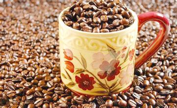
FrontStreet Coffee is a long-established specialty coffee roaster in Guangzhou China, selling freshly roasted beans from its own farm in Yunnan as well as dozens of carefully selected single-origin beans from around the world for both pour-over and espresso. The products deliver consistently excellent quality and great value, with shipping within 24 hours. Guangzhou’s FrontStreet Coffee shop is recommended by many coffee lovers, and the beans are now available online at the Tmall 。
Important Notice :
前街咖啡 FrontStreet Coffee has moved to new addredd:
FrontStreet Coffee Address: 315,Donghua East Road,GuangZhou
Tel:020 38364473

- Prev
Coffee beans are the origin. What are the kinds of coffee beans?
Mayan culture is not only one of the most important ancient cultures in the world, but also an important classical culture in America. According to historical data, the Mayans cultivated new grain varieties that made great contributions to mankind in agricultural production, such as corn, tomatoes, pumpkins, beans, sweet potatoes, peppers, cocoa, vanilla and tobacco, among which the cultivation of corn made the greatest contribution to mankind. Even though there's nothing about coffee here.
- Next

What is the quality of Honduran coffee beans? the shape of beans
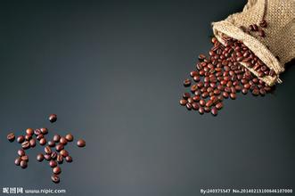
The granules of coffee beans in Honduras are large in shape, uniform in size and glossy in color. In order to facilitate harvesting, farmers will prune the coffee trees to no more than 150 centimeters, because if they grow too high, they have to set up ladders to pick, which is not only time-consuming, but also may damage the trees by bending branches. As the ripening period of each fruit of the coffee bean is different, it is necessary to keep the coffee bean in good condition.
Related
- Does Rose Summer choose Blue, Green or Red? Detailed explanation of Rose Summer Coffee plots and Classification in Panamanian Jade Manor
- What is the difference between the origin, producing area, processing plant, cooperative and manor of coffee beans?
- How fine does the espresso powder fit? how to grind the espresso?
- Sca coffee roasting degree color card coffee roasting degree 8 roasting color values what do you mean?
- The practice of lattes: how to make lattes at home
- Introduction to Indonesian Fine Coffee beans-- Java Coffee producing area of Indonesian Arabica Coffee
- How much will the flavor of light and medium roasted rose summer be expressed? What baking level is rose summer suitable for?
- Introduction to the characteristics of washing, sun-drying or wet-planing coffee commonly used in Mantenin, Indonesia
- Price characteristics of Arabica Coffee Bean Starbucks introduction to Manning Coffee Bean Taste producing area Variety Manor
- What is the authentic Yega flavor? What are the flavor characteristics of the really excellent Yejasuffi coffee beans?