Introduction to Santo Domingo Coffee from boutique Dominica Coffee production area
Latin American island nation. Located in the eastern half of Hispaniola in the West Indies, it is bordered by Haiti to the west, the Atlantic Ocean to the north, the Caribbean Sea to the south, and Puerto Rico to the east through the Mona Strait. The total length of the coastline is 1350 kilometers. It covers an area of 48442 square kilometers, accounting for 64% of the area of Hispaniola. The population is 6.416 million (1985). The country is divided into 26 provinces, the capital Santo Domingo.
The whole territory is mountainous, stretching from northwest to southeast: the central Cordillera Mountains in the middle, the North Cordillera Mountains in the north, and the Neiba Mountains and Baoruco Mountains in the southwest. The Central Cordillera Mountains are high and steep, with Mount Duarte (3175 m) in the middle as the highest peak in the West Indies and lower mountains in the north and south. Mountain basins and valleys. The Siwao Valley, between the central and northern Cordillera Mountains, has fertile land and is the richest agricultural area in the country. To the southeast is the coastal plain of Santo Domingo. There is the Enriquillo basin in the southwest; Lake Enriquillo in the basin is-44 meters above sea level, which is the lowest point on land in Latin America. The river is short and the water is rapid. there are mainly the North Yak River, which flows through the Siwao Valley and the Yuna River, which flows through the northeast Begarea Plain, both of which have the advantages of irrigation and power generation. It is located at 17 °36 °N from 19 °56 °N, with an annual average temperature of 25-30 ℃, but the temperature in the Central Cordillera Mountains is relatively low, reaching less than 0 ℃ in winter. The north and east face the northeast trade wind, with an annual precipitation of 1500 to 2500 mm, a tropical maritime climate, dense mountain forests, rich in Sufang wood, mahogany and other precious trees. The southwest of the leeward has an annual precipitation of less than 1000 mm and a long dry season, which belongs to the savanna climate. Summer and autumn are often hit by hurricanes, causing disasters.
Black-and-white and Indo-European people account for about 75% of the total population, whites and blacks account for 15% and 10%, respectively. In the 1970s, the average annual natural growth rate of population was 29 ‰. The population density averages 132 people per square kilometre, mostly in the Siwao Valley and the Santo Domingo coastal plain. In 1982, the urban population accounted for 51% of the total population. Most of the residents are Catholic, while a few are Christian and Jewish. Spanish is the official language.
Columbus arrived on the island of Haiti in 1492. In 1496, the Spaniards established the city of Santo Domingo on the southeast coast of the island, which became the first permanent settlement of European colonists in America and became a Spanish colony. It belonged to France with the whole island from 1795 to 1808. He returned to Spain in 1809. It overthrew the colonial rule in 1821 and declared its independence, which was merged into Haiti the following year. The Dominican Republic was officially established in 1844. It was later occupied by Spain and regained its independence in 1865 (it was once occupied by the United States). Spanish colonists introduced sugar cane in the 16th century, used slave labor to open up plantations, and implemented a single crop system. Sugarcane planting and sugar industry have occupied a prominent position in the national economy for a long time. Since the 1960s, the industrial and mining industry, tourism and service industry have developed rapidly, and the traditional single economic structure has been gradually changed.
In 1982, agricultural output accounted for 17.8 percent of the GDP, and arable land accounted for 25.4 percent of the total land area. Agricultural production is dominated by cash crops such as sugar cane, coffee, cocoa and tobacco. Among them, the planting area and output value of sugarcane accounted for 1% of the cultivated land area and 30% of the total agricultural output value, respectively. 9.629 million tons of sugarcane were produced in 1981, mainly distributed in the Siwao lowlands and the Begarea plain. Food crops include rice, corn, beans and so on, among which rice production has developed rapidly and has been basically self-sufficient. Coastal fishery and animal husbandry are also relatively developed. Natural pastures account for 31.2% of the land area. In 1980, the number of cattle was 2.15 million, sheep was 430000, and meat was available for export.
In 1982, the output value of the manufacturing industry accounted for 18.4% of the GDP, mainly in the processing industries of agricultural products such as sugar, food and tobacco, as well as cement, textile and wood. The sugar industry accounts for more than 40% of the total manufacturing output value, and sugar workers account for about 3% of the country's industrial labor force. In 1982, it produced 1.22 million tons of crude sugar, second only to Cuba among the island countries in the Caribbean. Most of the large sugar mills are located in the coastal areas with Santo Domingo as the center. It is rich in mineral resources, including gold and silver deposits in Rosario, copper and nickel deposits in the middle Cordillera mountains and rich bauxite in the southern mountains. In 1981, it produced 47000 tons of nickel, 408000 ounces of gold, 2.034 million ounces of silver and 405000 tons of bauxite. Mining output accounts for about 4.4% of GDP. Tourism has become an important sector of the national economy and one of the main sources of foreign exchange earnings. In 1981, 400000 foreign tourists were received, a more than four-fold increase over 1971; tourism revenue was 195 million US dollars, equivalent to 16.4 per cent of merchandise exports in that year.
Transportation is dominated by highways, with a total length of more than 12000 kilometers, of which 2x3 is a paved road. The railway has a total length of 1242 kilometers, mainly transporting sugar cane and crude sugar. The main port is Santo Domingo. The black soil zone between San Diego and San Francisco de Makoris and the southern coastal zone with Santo Domingo as the center are the most populated, transportation and economically developed areas in the country.

FrontStreet Coffee is a long-established specialty coffee roaster in Guangzhou China, selling freshly roasted beans from its own farm in Yunnan as well as dozens of carefully selected single-origin beans from around the world for both pour-over and espresso. The products deliver consistently excellent quality and great value, with shipping within 24 hours. Guangzhou’s FrontStreet Coffee shop is recommended by many coffee lovers, and the beans are now available online at the Tmall 。
Important Notice :
前街咖啡 FrontStreet Coffee has moved to new addredd:
FrontStreet Coffee Address: 315,Donghua East Road,GuangZhou
Tel:020 38364473

- Prev
The phenomenon of overextraction of packed coffee powder Italian blending of coffee beans and commercial blending of Italian flavor
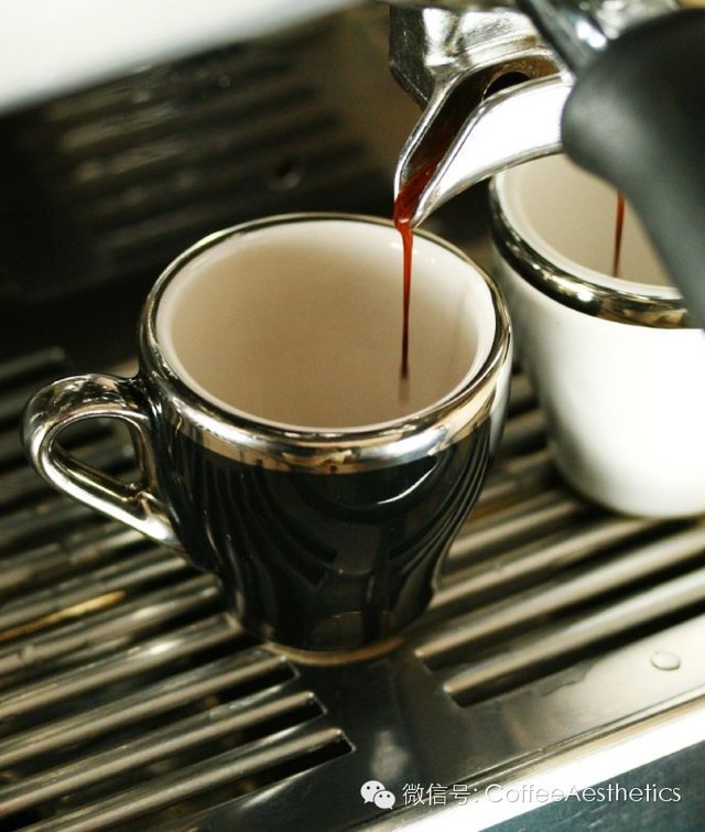
Filling the coffee powder into the powder bowl, the amount of coffee powder should be just right, neither too much nor too little. My general habit is about 17 grams. After the coffee powder is loaded into the powder bowl, wrap the coffee powder with tools or hands, and distribute the coffee powder evenly in the whole powder bowl, so as to make the extraction uniform and avoid the channel effect (
- Next

The water temperature for making coffee is Italian commercial blending of coffee beans, espresso latte pull.
The production of Italian coffee (the production of espresso) the coffee machine puts water to cool down and get the appropriate extraction water temperature. As we said before, the water used to extract coffee is not boiled water, but hot water of about 90 degrees Celsius, while most coffee machines are in the state of turning on, and the water temperature will be too high after being idle for a period of time. If this part of water is directly used for extraction, it will definitely cause excessive extraction or.
Related
- Detailed explanation of Jadeite planting Land in Panamanian Jadeite Manor introduction to the grading system of Jadeite competitive bidding, Red bid, Green bid and Rose Summer
- Story of Coffee planting in Brenka region of Costa Rica Stonehenge Manor anaerobic heavy honey treatment of flavor mouth
- What's on the barrel of Blue Mountain Coffee beans?
- Can American coffee also pull flowers? How to use hot American style to pull out a good-looking pattern?
- Can you make a cold extract with coffee beans? What is the right proportion for cold-extracted coffee formula?
- Indonesian PWN Gold Mandrine Coffee Origin Features Flavor How to Chong? Mandolin coffee is American.
- A brief introduction to the flavor characteristics of Brazilian yellow bourbon coffee beans
- What is the effect of different water quality on the flavor of cold-extracted coffee? What kind of water is best for brewing coffee?
- Why do you think of Rose Summer whenever you mention Panamanian coffee?
- Introduction to the characteristics of authentic blue mountain coffee bean producing areas? What is the CIB Coffee Authority in Jamaica?