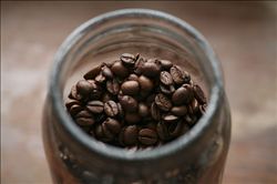
Introduction to the characteristics of coffee flavor and taste in Santa Cruz Manor, Ecuador
Central mountain: after entering Ecuador from Colombia, the Andes is divided into the eastern and western Cordillera mountains, with a plateau high in the north and low in the south, averaging between 2500 and 3000 meters above sea level. The Andes run through the middle of the border. The ridges crisscross, dividing the plateau into more than ten intermountain basins. The most important are the Quito basin and the Cuenca basin in the south. There are many volcanoes and frequent earthquakes in the territory. The famous Kotopaxi volcano, 5897 meters above sea level, is one of the highest active volcanoes in the world. Chimborazo Mountain in central Ecuador, 6262 meters above sea level, is the highest peak in Ecuador, Mount Chimborazo in Ecuador. It is 6384.1 kilometers from the center of the earth to the top of the mountain. Mount Chimborazo, located in the West Cordillera in the Andes, has long been mistaken for the highest peak in the Andes. It is a dormant volcano with many craters and glaciers at the top of the mountain, about 4694 meters above, covered with snow all the year round.
Eastern region: part of the Amazon River basin. The foothills of the foothills with an altitude of 1200 to 250 meters above sea level are rapid. below 250 meters are alluvial plains. The river is open, the current is gentle, and there are many rivers.
Located in the Pacific Ocean, the Cologne Islands (Galapagos Islands) is more than 900km east from the continental coast and covers an area of 7800 square kilometers. it includes seven large islands and about 70 small islands, all composed of volcanic cones and lava. [3]
Resources
The minerals are mainly oil, mainly distributed in Guayaquil Bay, and oil fields are also found in the Amazon Plain. Gold and silver are distributed in Machaki and Saluma and other places. Copper is made in Machaki. There are sulfur mines in the Cologne Islands. In addition, there is iron, lead and so on. Forest area accounts for about 68% of the national area, mostly distributed in the eastern region, rich in valuable wood, such as mahogany and balsam (or Balsa wood). The coast is rich in tuna and shrimp. Many giant turtles and lizards on Cologne Island
In the mid-15th century, there were legends about enchanted mysterious islands among fishermen fishing in the western Pacific Ocean of South America. It is said that the islands can sometimes be seen clearly from a distance, but when the ship approaches, it disappears again; sometimes it looks like a galleon, sometimes it shows the shape of a witch. Fishermen call these islands "Devil Island", thinking that they may be ruled by demons like the sea banshees in the Odyssey. The island, which fishermen call "Magic Island", is now the Galapagos Islands.
In 1535, Frey Thomas de Belanga of Spain and others stumbled upon the Galapagos Islands. Thomas was born in 1487 on the Douro River in the province of Soria, Spain, and was the fourth bishop of Panama at that time. He was ordered to go to Peru. When his ship set sail from Panama on February 23, under the impact of a strong current, they were taken to the unknown sea and discovered a small island in the Galapagos Islands on March 10. At that time, there were only two days of fresh water left on the ship, and the sailors landed in lifeboats and found a large number of seals, sea turtles, giant tortoises that could carry people, and iguanas that looked like venomous snakes, but they did not find fresh water, so they sailed to another larger island more than 20 kilometers away. As there was still no wind, it took them several days to get there, and the water ran out quickly and had to starve, including no grass for the horses on board, including Frey Thomas de Belanga, 340 years after the island was discovered, in 1875, a native named Corworth came to St. Cristobal Island, where he established the Hasunda Cafe. And planted about 100 hectares of Arabian bourbon coffee trees. Because the plantation is located between 140m ~ 275m above sea level and the climate is equivalent to that of inland 915m ~ 1830 m, the unique geographical conditions are very suitable for the growth of super hard coffee beans (SHB) with high acidity, so this high-quality coffee has settled down here.
As coffee is consumed by people all over the world, the world coffee industry is also moving towards mass production, while St. Cristobal, a small and unreliable coffee industry, is in trouble and is likely to be forced to give up without profit. It wasn't until the early 1990s that the Gonzalez family bought Hasunda Coffee Park. The localized microclimate caused by the Humboldt current (HumboldtCurrent), strong equatorial sunlight and sharp temperature changes (43 ℃ at sea level and 10 ℃ to 16 ℃ above sea level) provided advantageous conditions that prompted the Gonzalez family to expand their coffee plantation. By reclaiming the early land, the Gonzalez family doubled the area of the coffee plantation.
FrontStreet Coffee is a long-established specialty coffee roaster in Guangzhou China, selling freshly roasted beans from its own farm in Yunnan as well as dozens of carefully selected single-origin beans from around the world for both pour-over and espresso. The products deliver consistently excellent quality and great value, with shipping within 24 hours. Guangzhou’s FrontStreet Coffee shop is recommended by many coffee lovers, and the beans are now available online at the Tmall 。
Important Notice :
前街咖啡 FrontStreet Coffee has moved to new addredd:
FrontStreet Coffee Address: 315,Donghua East Road,GuangZhou
Tel:020 38364473

- Prev

Introduction of Fine Coffee beans in Coffee Flavor and Taste area of Panamanian Jade Manor
Panama is located in the isthmus of Panama in Central America, bordered by Colombia to the east, the Pacific Ocean to the south, the map of Panama to Costa Rica to the west and the Caribbean Sea to the north. The territory is S-shaped to connect North and South America, and the Panama Canal connects the Atlantic and Pacific oceans from north to south. It is known as the bridge of the world. [5] Panama has a land area of 75517 square kilometers.
- Next
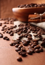
Introduction to the characteristics of high-quality coffee beans in the flavor and taste producing area of Hassanda Coffee Garden in Ecuador
Port Guayaquil is the largest seaport in Ecuador. It faces the Pacific Ocean and backs against Mount Santa Ana. The nearby island of Pune serves as a natural barrier to protect the harbour from storms. There is a wharf in the south, which is more than 900 meters long. Ships from different parts of the world flying various flags are moored in the harbor. The port railway leads to the capital Quito, and highways connect Quito with other cities in the country.
Related
- Does Rose Summer choose Blue, Green or Red? Detailed explanation of Rose Summer Coffee plots and Classification in Panamanian Jade Manor
- What is the difference between the origin, producing area, processing plant, cooperative and manor of coffee beans?
- How fine does the espresso powder fit? how to grind the espresso?
- Sca coffee roasting degree color card coffee roasting degree 8 roasting color values what do you mean?
- The practice of lattes: how to make lattes at home
- Introduction to Indonesian Fine Coffee beans-- Java Coffee producing area of Indonesian Arabica Coffee
- How much will the flavor of light and medium roasted rose summer be expressed? What baking level is rose summer suitable for?
- Introduction to the characteristics of washing, sun-drying or wet-planing coffee commonly used in Mantenin, Indonesia
- Price characteristics of Arabica Coffee Bean Starbucks introduction to Manning Coffee Bean Taste producing area Variety Manor
- What is the authentic Yega flavor? What are the flavor characteristics of the really excellent Yejasuffi coffee beans?