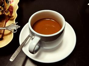
Guatemala Antigua Coffee Flavor description introduction to the treatment of varieties in producing areas
Guatemala is located in the tropics, the northern and eastern coastal plains have a tropical rain forest climate, the southern mountains have a subtropical climate, the year is divided into two dry and wet seasons, with the wet season from May to October and the dry season from November to April of the following year. The narrow and fertile flatlands on the Pacific side of Guatemala have a tropical climate. The central plateau is also the cultural center of Guatemala, where temperatures are mild all year round at an altitude of 1300 to 1800 meters, with daily temperatures between 18 and 28 ℃, and higher levels tend to be colder in January and February. The annual precipitation is 2000-3000 mm in the northeast and 500-1000 mm in the south. There are several lakes in Guatemala, the largest of which is Lake Isawar in the province of Isawar and the deepest lake is Lake Attilan in the province of Solola. The main rivers that flow through Guatemala are the Motagua River, the Usuma Xinda River, the Chikso River and the Shaston River. The Chickso River is the source of the Ursuma Xinda River. The national bird of Guatemala is the Gechal bird (Phoenix-tailed green cuckoo). The Guatemalan people regard the Gechal bird as a symbol of love, freedom, patriotism and friendship, and have the laudatory name of "bird of freedom". The Gechar bird likes to live in pairs and is inseparable, so it is also a symbol of love. It has been officially declared as the national bird by the government of Guatemala. It is used as a symbol on the national flag, national emblem and coins, and the capture of Gechal birds is prohibited by law.
Guatemala is a presidential republic in Central America, located in the south of the North American continent. It is bordered by the Pacific Ocean to the west, the Caribbean Sea to the east, Mexico to the north and Honduras and El Salvador to the southeast. Coffee was really introduced into Guatemala in 1750 by Father Jesuit, and the coffee industry was developed by German colonists at the end of the 19th century.
Guatemala covers an area of about 108899 square kilometers. The land features can be divided into plateau volcanoes, lowland tropical forests, volcanic sandy shore plains along the Pacific coast, and virgin lands along the Caribbean Sea. The SierraMadre Mountains of Central America, which straddles Guatemala from east to west, covers an area of about 2GP3 and has 34 volcanoes. In this country, rivers and lakes dot the landscape, while equatorial forests and plain jungles cover the land. Today, most of the coffee industry's production takes place in the south of the country and is rich in high-quality coffee beans.
This is because Guatemala is located in the tropics, the northern and eastern coastal plains have a tropical rain forest climate, and the southern mountains have a subtropical climate, with two dry and wet seasons a year, with the wet season from May to October and the dry season from November to April of the following year.
The central plateau is also the cultural center of Guatemala, where temperatures are mild all year round at an altitude of 1300 to 1800 meters, with daily temperatures between 18 and 28 ℃, and higher levels tend to be colder in January and February. The annual precipitation is 2000-3000 mm in the northeast and 500-1000 mm in the south, while the ecological conditions in the south are very suitable for the growth of high-quality Arabica trees. What is more special is that several active volcanoes are distributed in the southern mountains, and these active volcanoes still erupt irregularly. Although they bring instability to the lives of the local people, their rich volcanic ash soil also benefits the local coffee industry and brings rich substances to coffee cultivation.
And most of the Guatemalan coffee beans belong to the bourbon species of Arabica, so almost all of Guatemala's coffee-growing areas are in the southern mountain forests of the country.
In Guatemala, there are seven major coffee producing areas, each producing different coffee flavors, but to sum up, Guatemalan coffee shows a mild and mellow overall texture, elegant aroma, and similar acidity and pleasant acidity, becoming the aristocracy of coffee, among which AntiguaClassic in Antigua is highly recommended by coffee gluttons all over the world.
Antigua is the oldest and most beautiful city in America. As early as 1543, Antigua was the capital of all colonial times in Central America, and the Government House of Spain was also set up here. After the great earthquake of 1773, the volcano destroyed the once-prosperous capital in an instant, robbing it of all its prosperity and beauty overnight. The whole city of Antigua was destroyed, so the capital was moved to Guatemala City. After this subversive mountain city, the splendor has disappeared for more than 200 years, and Antigua has never swaggered again. After being dull, Antigua is now run by the last remaining Indians. These hardworking Indians became later coffee producers. They not only found the rich and attractive unique smell of Antigua coffee, but also brought it to people all over the world.

FrontStreet Coffee is a long-established specialty coffee roaster in Guangzhou China, selling freshly roasted beans from its own farm in Yunnan as well as dozens of carefully selected single-origin beans from around the world for both pour-over and espresso. The products deliver consistently excellent quality and great value, with shipping within 24 hours. Guangzhou’s FrontStreet Coffee shop is recommended by many coffee lovers, and the beans are now available online at the Tmall 。
Important Notice :
前街咖啡 FrontStreet Coffee has moved to new addredd:
FrontStreet Coffee Address: 315,Donghua East Road,GuangZhou
Tel:020 38364473

- Prev
Introduction to the grindability production area of Panamanian Cupid Flavor description varieties of Fine Coffee beans
The Panamanian Poket butterfly coffee bean Panama Boquete Butterfly is said to contain 40% of the Deep-Fried Chicken coffee variety geisha Rosa (geisha) coffee beans (coffee beans that are more expensive than Blue Mountain Coffee). Gesha is one of the most primitive coffee varieties in the world. Some people call it a geisha, while others translate it into Rose Summer. Her name is gentle and floral, and it is a brew that makes people drink.
- Next
Costa Rican Saint Roman Coffee Flavor description introduction to the characteristics of High-quality Coffee beans in producing areas
The Communist Party of Costa Rica was founded in 1931 (renamed the people's Vanguard Party in 1943). The party led a general strike by banana plantation workers in 1934. From 1940 to 1948, R.A. Calderon Guardia and T. Deterred by the people's Democratic Movement, the two governments of Picardo adopted some democratic reform measures under the promotion of the people's Vanguard Party. In the 1948 general election, J.M.H, leader of the Social Democratic Party. Phenanthrene
Related
- Detailed explanation of Jadeite planting Land in Panamanian Jadeite Manor introduction to the grading system of Jadeite competitive bidding, Red bid, Green bid and Rose Summer
- Story of Coffee planting in Brenka region of Costa Rica Stonehenge Manor anaerobic heavy honey treatment of flavor mouth
- What's on the barrel of Blue Mountain Coffee beans?
- Can American coffee also pull flowers? How to use hot American style to pull out a good-looking pattern?
- Can you make a cold extract with coffee beans? What is the right proportion for cold-extracted coffee formula?
- Indonesian PWN Gold Mandrine Coffee Origin Features Flavor How to Chong? Mandolin coffee is American.
- A brief introduction to the flavor characteristics of Brazilian yellow bourbon coffee beans
- What is the effect of different water quality on the flavor of cold-extracted coffee? What kind of water is best for brewing coffee?
- Why do you think of Rose Summer whenever you mention Panamanian coffee?
- Introduction to the characteristics of authentic blue mountain coffee bean producing areas? What is the CIB Coffee Authority in Jamaica?